The 6th Bomb Group
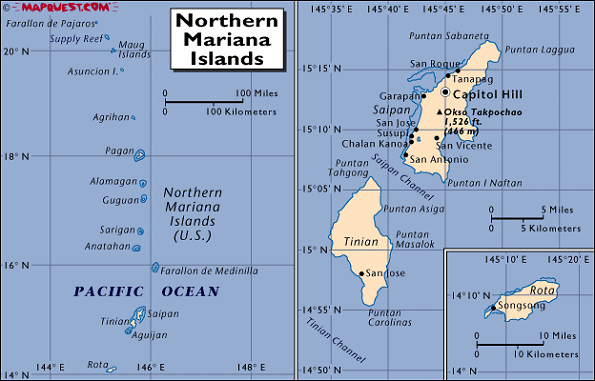
Tinian Island - Geography and History of the Island
Geography of the Island
|
|---|
Tinian was a little, green, flat, semi-tropical island formed by pre-historic volcanoes and coral animals.
It lay just three miles southwest of Saipan with its clearly visible harbor of ships and its high mountain, and about 125 miles
northeast of Guam.
Of the fifteen islands in the Marianas group, Tinian was one of the four largest.
It averaged four miles in width and eleven miles in length.
Heavy growth of cane greeted the Sixth, but the vegetation was not tropical; the trees were evergreen, mostly pine. |
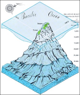
The Geology of the Island: Millions of Years in the Making
|
|---|
The geology of Tinian is also interesting. Tinian, Saipan and Aguijan are the worn down peaks of an ancient volcano. This volcano extends more 6 miles above the Marianas trench, which is the deepest point in any ocean on earth. Over the years, the wind and water eroded the peaks and created the caves that everyone liked to explore and where the Japanese liked to hide. Starting in prehistoric times, sea creatures left deposits encrusting Tinian with limestone and coral. Or in the accurate but indecipherable language of a geologist:
Sometime later, Tinian was also covered by a load of crap (among other things), creating the soil which supported plant life and made Tinian suitable for grazing cattle and growing sugar cane. |
The Early History of the Island
The Marianas first appear in recorded history as a stopping place for Magellan's around-the-world voyage in 1521. As a result of this discovery the islands were a Spanish possession for four centuries. The early Jesuit priests named the islands for their patroness Queen Maria Anna. Natives were called Chamorros. In 1898 the American Navy captured Guam and the United States bought it from Spain at the close of the Spanish-American War. The other islands were sold to Germany. ["Pirate's Log", p. 25] However, long before the Europeans arrived, the island had been settled by prehistoric seafaring people who left many monuments on the island. |
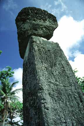
A "latte stone" left behind by the Chamorro
|
|---|
Japanese Occupation of the Island
The islands, except Guam, fell to Japan as mandated territory at the end of World War I. In violation of the Versailles treaty Japan fortified the islands and brought in Japanese, Okinawans and Koreans to till the rich black soil and to construct the concrete blockhouses. Under the Japs, Tinian consisted of sugar cane farms, a concrete town, and the harbor, with ox-cart trails and a narrow gauge railroad connecting them. In later developments, small airfields were constructed. [From "Pirate's Log", pp. 25-26] |
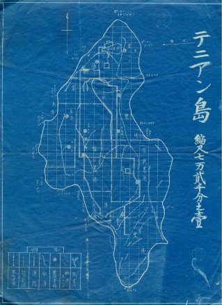
A Japanese Map of the Island in the early 1940s.
|
|---|